
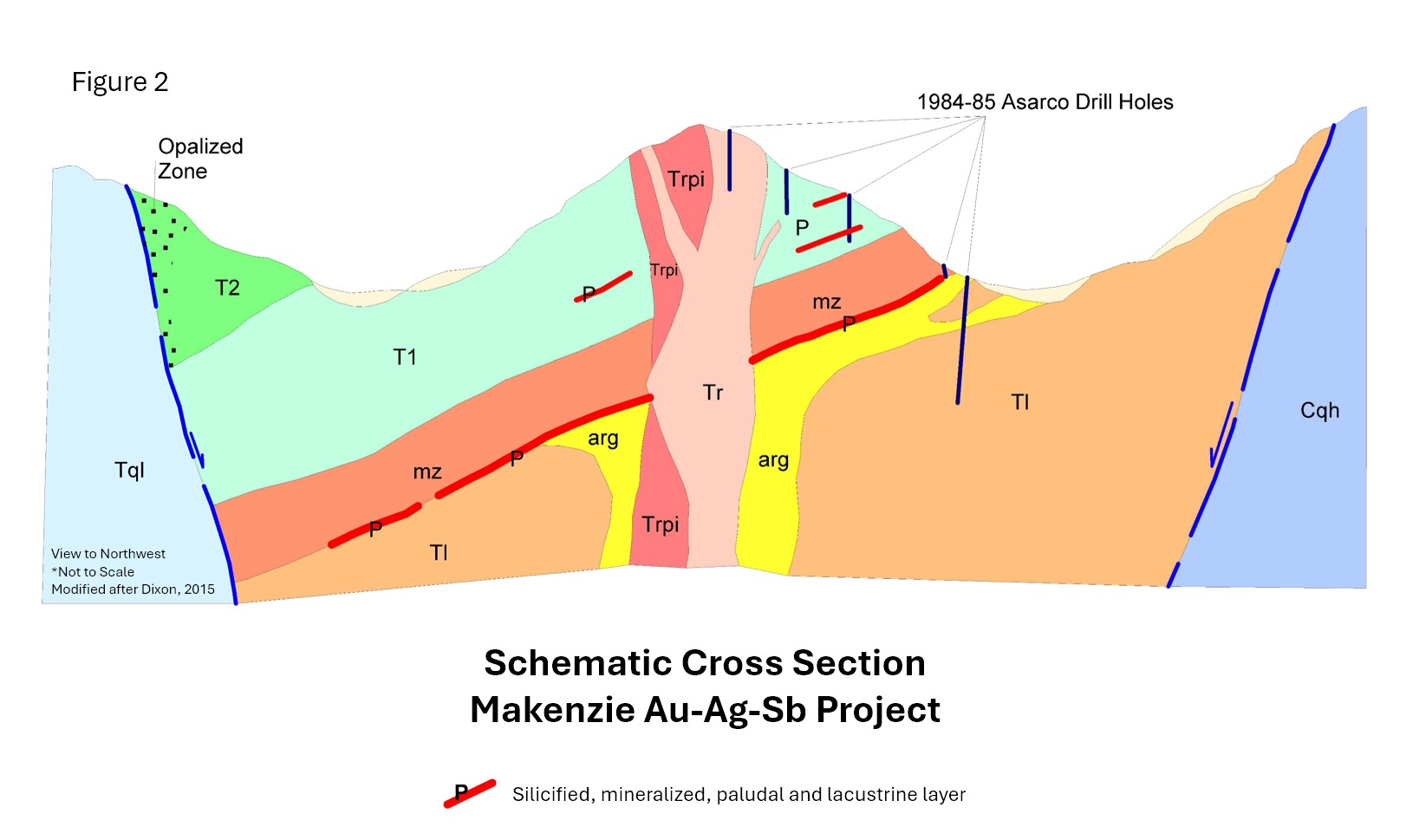
The Makenzie gold, silver, antimony project is a low sulfide, epithermal style multi-vein underground target located 44 km south-southeast of Austin in the Toiyabe Range in central Nevada (“the Makenzie Project”). Makenzie lies 48 km north-northwest of Round Mountain (> 10m ozs Au, Kinross Gold Corp) and 74 km northeast of Paradise Peak (1.6m ozs Au + 24m ozs Ag produced from 1986 to 1994) with both projects having a similar geological setting to Makenzie. The Makenzie project represents one of the largest untested, gold, silver, and antimony anomolies in Nevada. In 1984/85 ASARCO Exploration drilled 13 (mainly shallow) vertical rotary drill holes focused on a potential near-surface disseminated gold target.
The first two drill holes SJC841 1 and 2 were drilled to a depth of 900 feet. The remaining two holes were drilled to a maximum depth of 900 feet (274m). However, the drill holes were poorly located to intersect the mapped structures and too shallow to intersect with the targeted veining identified by Meryllion.
Additional exploration work carried out from 2007 to 2009 by Silverthorn Exploration included mapping and sampling across claim block.
- 277 rock chip samples
- A 100m x 100m sail sampling grid across the entire claim block
- Across the Rhyolite Hill target area, the sampling was closed down to 100m x 50m where mapping had indicated more intense argillic alteration
- > 700 soil samples were assigned
- A ground magnetics and VLF geophysical survey were completed in 2008. This data is currently being sought.
For details of the transaction please refer to news release dated 14 July 2025